Chanderi (Karjat Region)
5th Jul 2008
Trek to Chanderi with Ashok, Kripa and her colleagues. Brilliant monsoon trek.
From Pune, Ashok and I got there by train, 5:45 am – Vangni station finds Ashok trying to nap while we start our long wait for the Bombay-ites to join us. The others are delayed. We agreed to start on the trek, and they’d catch up later. So we took an autorickshaw, which dropped us off at base village of the trek, Chinchli, at the end of the road (literally). The sleepy little village of Chinchli nestles in a hollow below the mighty Chanderi and Maismal.
The trek proper starts off with fording a river. Ashok poses and grins at the camera from the deepest point in the stream – about knee high. We passed the time near the stream, waiting for the rest to arrive… they were just 15 mins away now. Kripa and her colleagues joined shortly – we started walking up, ~9:15am.
Then a gentle ascent of a spur, a long lush plateau walk, crossing and re-crossing a stream almost half the way up. Chinchli village looks a little cluster of red brick roof tops, seen from midway up the spur, about 15 mins into the hike. There are no words to describe the idyllic charm of this part of the world.
The long flat walk from the spur to the base of the Chalderi-Maismal col. I am obsessed with spotting teak trees and saplings throughout – the photo I capture does not capture the rough, sand papery texture of these large broad teak leaves. They are roughly the size of dinner plates, ~30 cm in diameter! The teak saplings seem to be planted in orderly rows along the long plateau between Chinchli and Chanderi. We pass a water-logged meadow, which I label “Pond for reflection”. Soon we get our first misty view of Chanderi. Local calves graze on the plateau. A petrefied little outdoor lizard quite nicely camouflaged, barely escapes being stepped upon. I spotted a wild Champa tree, and some clumpy white flowers on grass, that I looked up, could be white kyllinga (Kyllinga nemoralis).
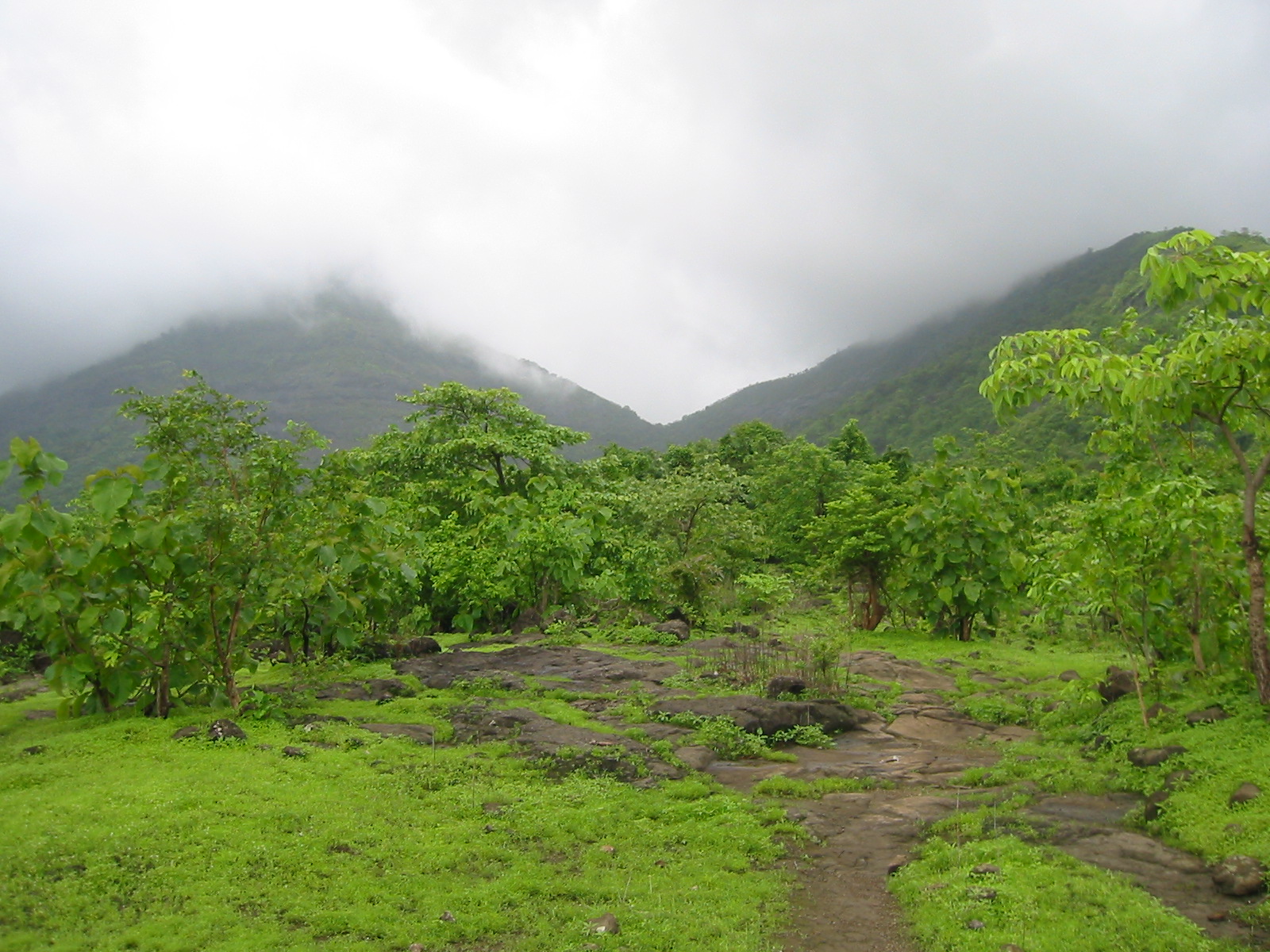
We pass through a beautiful green forested section after traversing the plateau – the shades of green only to be seen during the monsoons. Lush doesn’t quite describe it. An eye-catching patch of red leaves occasionally contrasts with the green. Somewhere around here Maismal, the twin peak with Chanderi, appears ghostly and looming out of the mist.
We walked past a zillion delightful waterfalls on streams. Found one which we unanimously agreed was the glorious one, and horsed around in it, soaking through our clothes. This is one of the pleasures of a monsoon hike, getting soaked either in rain or in waterfalls and streams, and not caring. It’s usually warm and tropical, not teeth-chattering cold. The sun made an appearance at about 11am. Looking down, the valley is bathed in a pale golden light.
The col!!! We made it to col! Taking a khakhra break – I take a photo of everybody to mark the moment. What lies ahead looks deceptively mild, but is quite a climb. Further along, we walk through a narrow path in the mist, the lush green grass to one side, mositure in the air, the dark moss hanging off trees making them look haunted. A species of cactus has even sprouted delicate green leaves!
Some windy exposed parts right near the top. Our path, helpfully marked with white arrows on the rocks all along, weaved in and out, criss-crossing the stream several times. The path markers take some of the fun out of the classic Chanderi trek (signified by losing one’s way many times and never reaching the top!). We managed to lose our way briefly, but did reach the caves at the top. We’re high enough now to see Chanderi shrouded in clouds.
The last 150 feet or so is the rocky peak of Chanderi (technical rock climb) – we only climb to the base of this rock. The rest is unclimbable without ropes and pitons (not to mention skills!). There was a fort up there, steps used to lead to it, but got blown away (by the British or the elements?) Can still see a turret-like stone construction way above to the right of the caves.
Near the rocky caves, a blob of rain nestling in the center of an awesome blossom plant (which is incidentally being blown in the high wind). I peeked around to see the other side of the mountain – and the wind blowing a red (religious) flag to tatters. There’s the ubiquitous temple on top of all hills in the Sahyadris. Looking to the left and right from our vantage point, I appreciate the solid, formidable granite, representing safety and protection – can easily see why the generals of the past chose these locations for their defensive forts.
While at the top, we got treated to a blanket of grey in the sky – threatening monsoon clouds over the whole earth, or so it seemed. I take one last look at Maismal peak disappearing into the clouds before turning downward.
The climb down was also quite something, having to watch every step on the rocks and for me personally, having to use my arms for those monstrous steps down, walk backwards facing the rocks in many places.. in all a full body workout. Back on the plains, we looked back at the col, but the peaks had disappeared entirely into cloud. Chanderi gives nothing away.